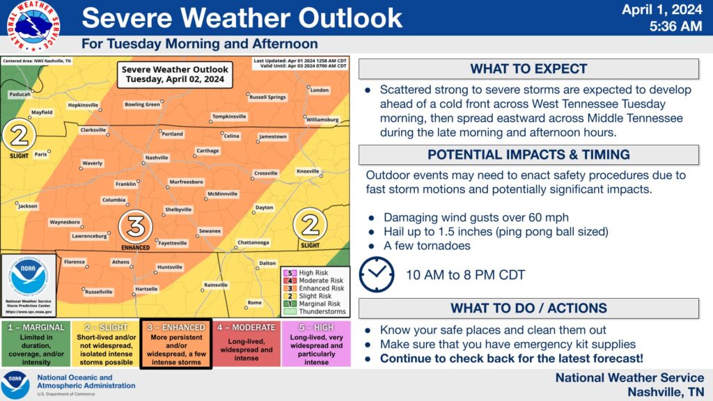
The National Weather Service says it’s confident that a line of severe thunderstorms will hit Middle Tennessee on Tuesday afternoon. The entire region faces a high risk for unusually severe weather, including winds up to 60 mph and hail the size of ping pong balls.
A chart from the weather service shows a “level 3” risk of severe weather from 1 to 8 p.m. tomorrow. That threat level indicates that the wind and downpour could be unusually intense, long-lasting, or widespread.
Though the main storm front will hit Tuesday afternoon and evening, smaller lines of storms could pop up earlier in the day. Meteorologists advise Middle Tennesseans to have a plan for taking shelter quickly — like in a basement or windowless room — and make sure your phone is charged and can receive severe weather alerts.
We posted this graphic yesterday, but it still holds true today! We are in the "day before" window, so make sure to do things like:
📅 Adjust plans if needed
📱 Make sure your WEA alerts are turned ON!
🏠 Go ahead and clean out your safe place today so that it is ready#TNwx https://t.co/aHeEW8UdHg— NWS Nashville (@NWSNashville) April 1, 2024
If you’d like to connect to others across the country facing severe weather (or want to use your severe weather planning for social media clout), the National Oceanic and Atmospheric Administration invites you to participate in the Safe Place Selfie challenge. Take a picture of yourself and your loved ones sheltering during the storms, and post it on Wednesday with the hashtag #SafePlaceSelfie.
Active weather is expected this week across much of the country.
A good reminder that knowing your safe place and being #WeatherReady is a 365 day/year effort.
And on Wednesday (April 3) we invite everyone to participate in #SafePlaceSelfie Day and challenge others. pic.twitter.com/mqg1st9BdE— NOAA WRN Ambassadors (@WRNAmbassadors) April 1, 2024

