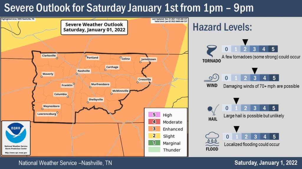
After mostly dodging heavy rains and storms on New Year’s Eve, the threat of severe weather remains for all of Middle Tennessee on New Year’s Day.
The National Weather Service expects a line of potentially severe storms to pass through between 1 and 9 p.m. Damaging straight-line winds and a few tornadoes — some strong — are possible, along with hail and localized flooding. The latest NWS briefing slides are online here.
A Tornado Watch is in effect until 6 p.m. Saturday for all of Middle Tennessee, a large swath of West and continuing across the border into Kentucky.
A tornado watch has been issued for parts of Kentucky and Tennessee until 6 PM CST pic.twitter.com/2UP2CIobdA
— NWS Nashville (@NWSNashville) January 1, 2022
A Flood Watch is also in effect until 9 p.m., which applies to Nashville and a swath of counties mostly along and north of Interstate 40. Rain totals could be 1 to 3 inches.
 Courtesy National Weather Service
 This map shows the Flood Watch for Friday night through Saturday in Middle Tennessee.
As always, forecasters are urging people to have multiple ways to be alerted — like with a weather radio or a smartphone that isn’t silenced or in do-not-disturb mode.
While the temperature was 75 degrees late Saturday morning at Nashville International Airport, much colder temperatures are expected after storms sweep through. By Sunday, the high temperature will be around 50 degrees, and there’s a chance for snow showers — although very little accumulation is expected because of the warmth of the ground.
This story was updated at 11:20 a.m. Saturday to reflect the latest forecast.