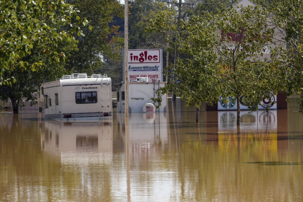
Appalachian communities faced flooding disasters last week because of two storms.
A cold front from the West dropped heavy rain on Wednesday in Tennessee and North Carolina, saturating soils. Then, the heat-fueled remnants of Hurricane Helene swept through Thursday and Friday.
“The combination of those two different weather systems really just made those three-day rainfall totals shoot up into pretty rare amounts,” said Wil Tollefson, Tennessee’s assistant state climatologist.
East Tennessee towns received between 6 and 9 inches of rainfall between the two storms — a lot of rain, and likely some local records, but far from state records. (For reference, about 13.5 inches of rain fell in Nashville over two days from one weather system during the May 2010 flood. In August 2021, McEwen, near Waverly, received more than 20 inches of rain in less than a day.)
North Carolina was hit harder. Yancey County, northeast of Asheville, recorded 24 inches of rain in three days: about 5 inches on Wednesday, 9 inches on Thursday and 10 inches on Friday, according to North Carolina’s mesonet data. Another station in the county run by the state’s forest service recorded 31 inches of rain.
 Courtesy North Carolina State Climate Office
 A station in Mount Mitchell State Park in Yancey County, North Carolina recorded about 24 inches of rainfall between September 25-27, 2024.
Excess water from North Carolina’s mountains thrashed into the Tennessee Valley via streams and rivers — setting new records for waterway heights, engulfing swaths of low-lying land and causing catastrophic damage.
Western North Carolina holds the Pigeon, Nolichucky and French Broad rivers, which flow into Tennessee. The Pigeon is impounded by the Walters/Waterville dam — on Friday, officials warned this dam had a catastrophic failure and evacuated the town of Newport, Tenn. before later retracting the statement. The Nolichucky River is impounded by the Tennessee Valley Authority’s Nolichucky Dam. Both rivers flow into the French Broad River.
The Pigeon River rose at least five feet above its previous record at gages in Newport. The National Oceanic and Atmospheric Administration recorded the river peaking at 28.9 feet, and the U.S. Geological Survey recorded the river peaking at about 30.5 feet. “Major” flood stage is defined as 12 feet.
The Nolichucky River in Embreeville nearly doubled in just four hours, rising from about 10 to 19 feet on Friday morning — then the gage stopped reporting data at 11:15 a.m. due to “equipment malfunction.” The river likely reached a record-breaking level, Tollefson said. The Nolichucky Dam broke its record elevation by about 9.5 feet, according to TVA.
Where will all of that water go?
The rain that fell as part of these storms has not finished its voyage, however.
Last week, TVA captured a lot of water through its system of dams and reservoirs. Douglas Lake, for example, rose by nearly 22 feet over three days, representing an increase of about 182 billion gallons of water, according to the utility.
This week, TVA will continue to slowly release water from some dams.
“The focus is on preventing additional flooding and moving water through the system to recover reservoir storage space in the event of additional rain in the coming days,” TVA spokesperson Scott Brooks said in a statement. “That includes record releases at places like Douglas Dam.”
Water from Douglas will flow into the French Broad River on its way to the Tennessee River, which flows into the Ohio River, onto the Mississippi River and then the Gulf of Mexico — back where the hurricane first formed.
This is a developing story. Storm data may change in the coming weeks as agencies review equipment and data collection.


