
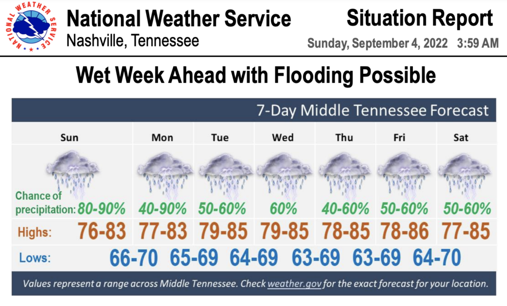
After a rainy start to Labor Day weekend, forecasters are issuing a flood watch due to the likelihood of more thunderstorms and heavy rain.
The Nashville office of the National Weather Service warns drivers to be on the lookout for flooded roads and other low lying areas. The watch is in effect through Monday evening — which could put a halt to outdoor gatherings and holiday cookouts.
FLOOD WATCH now in effect for most of #MiddleTennessee today through Monday evening. Additional widespread showers and thunderstorms are expected with heavy rainfall that could lead to quick flooding of roads and other low lying areas. Use caution if driving today and tomorrow! pic.twitter.com/5sjx4vFM24
— NWS Nashville (@NWSNashville) September 4, 2022
Neighborhoods that have already been met with several inches of rain during the past few days are most at-risk for quick flooding. Radar shows that seven inches of rain fell across Maury County.
A long period of scattered showers and thunderstorms are expected throughout the week. Some cities in the region could see rainfall of up to four inches.