Hurricane Helene remnants caused flooding that triggered landslides across Appalachia last month.
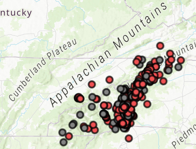
The U.S. Geological Survey had mapped 529 landslides as of Wednesday afternoon, primarily in North Carolina. About 360 of those landslides impacted rivers, roads and structures.
Last week, the agency launched a digital dashboard to show landslides caused in the aftermath of Helene, which struck the region just one day after another heavy rain event.
“We feel that activating our landslide event team in the aftermath of Helene was an essential step in providing federal, state, emergency managers, and rescue teams with the science information needed to assist with relief efforts,” Holly Weyers, the Southeast regional director for USGS, said in a statement.
North Carolina experienced the vast majority of this land movement. Tennessee recorded 15 landslides, and Virginia and Georgia recorded a handful. The dashboard will be updated with any additional discoveries.
Heavy rainfall events cause landslides when the pores of soil are filled faster than the water can drain, elevating pore water pressure and reducing soil strength. This type of landslide happens fast and can travel far, according to USGS.
Extreme rainfall events have become more likely as the planet has warmed from the burning of fossil fuels, deforestation and animal agriculture. In turn, landslides have become a greater risk with climate change.
In the U.S., landslides kill an average of 25-50 people each year and cause billions of dollars of property damage.

