
Middle Tennessee is expecting a major winter storm this weekend, with high chances of snow, sleet and freezing rain. The National Weather Service expects areas south of I‑40 to see greater ice accumulation, and areas along and north of I-40 to receive more snow, with a possibility of more than 9 inches of snow in some places according to forecasts on Wednesday.
Tennessee Governor Bill Lee has officially declared a state of emergency ahead of this weekend’s anticipated snow and ice storm. Under Tennessee law, that declaration is a way of quickly shifting state agencies into response mode. When possible, the governor issues such orders ahead of a major weather event. That makes it easier for agencies to get everything ready before the storm arrives.
More: NashVillager Podcast: Preparing for a winter storm
Meanwhile, the Tennessee Emergency Management Agency is urging people to check in today on any neighbors or loved ones who may need extra help, especially older folks and people with disabilities.
The National Weather Service recommends having plenty of warm clothes and blankets, enough food to last a few days, fuel for vehicles and an updated first aid kit. The service also reminds people to properly ventilate emergency heat sources and, if the power goes out, to keep generators at least 20 feet away from their homes.
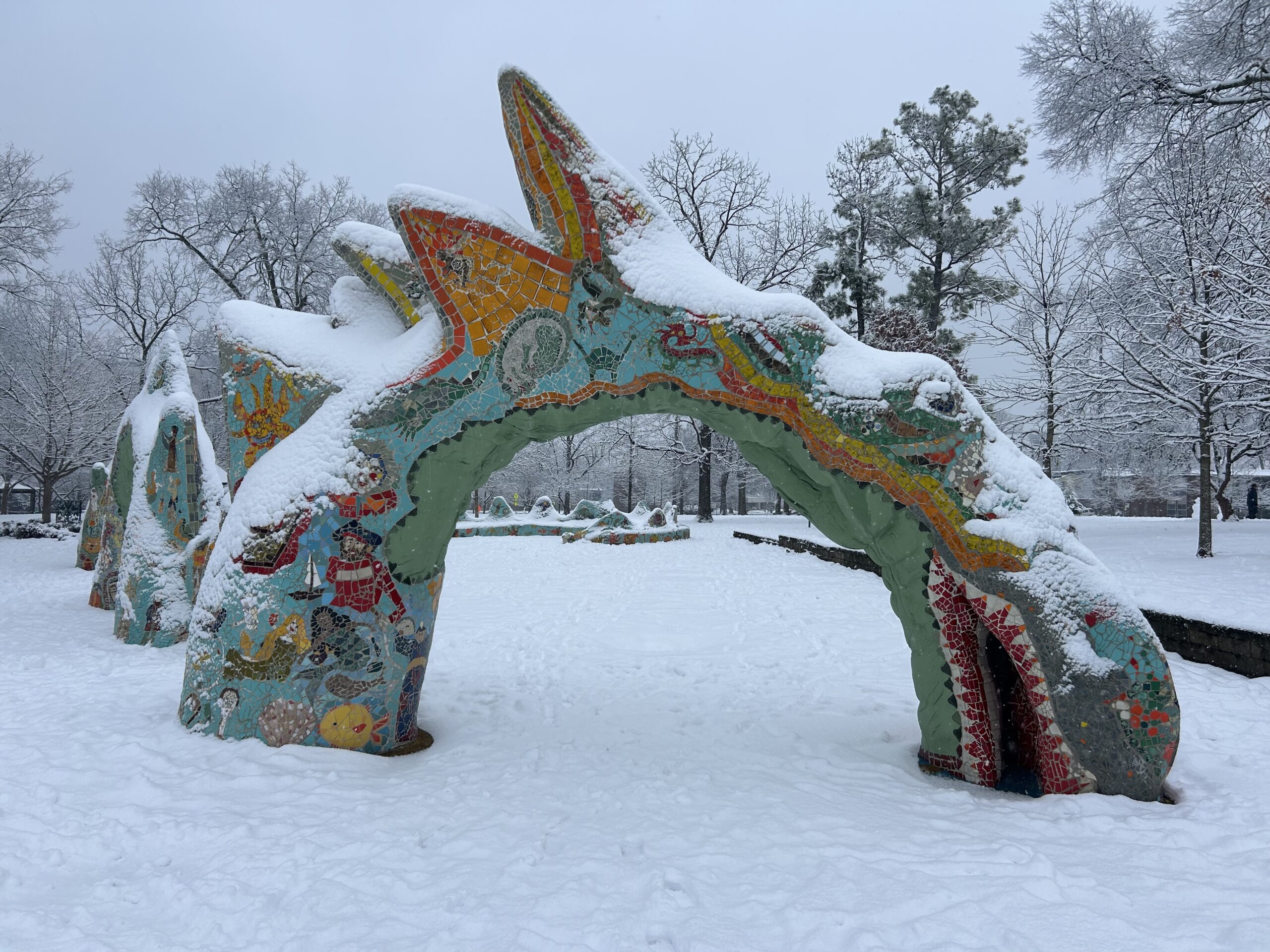 Rose Gilbert WPLN News
 Fannie Mae Dees Park, AKA “Dragon Park,” after a snowstorm in January, 2025.
The weather service is warning residents to expect moderate impacts including hazardous driving conditions, downed trees and possible power outages. Temperatures are expected to drop below freezing on Friday and and stay there well into next week, which should prolong disruptive conditions. Officials recommend that people take precautions such as dressing warmly, bringing pets indoors, grabbing groceries and keeping an eye on the latest forecast.
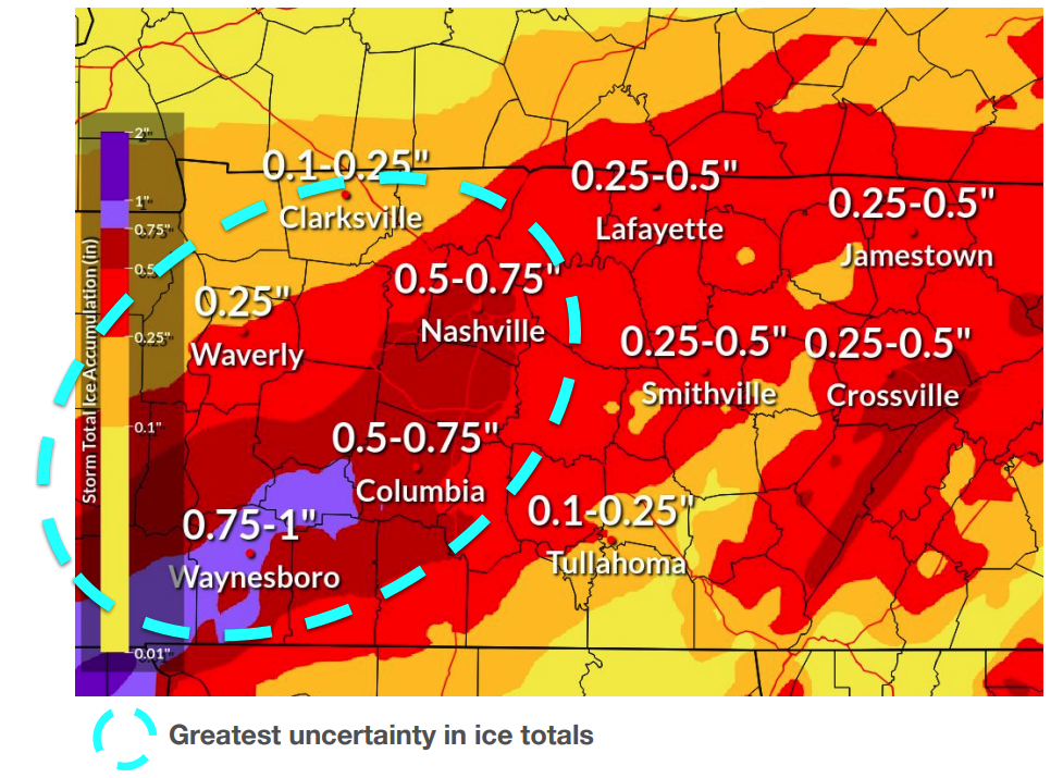
This map shows the National Weather Service forecast for ice accumulation in Middle Tennessee as of Friday morning.
Metro Social Services has activated its Severe Weather Response, offering emergency meal delivery to homebound residents like seniors and disabled folks before the storm hits.The service will also increase its number of senior house-calls and work with emergency services around the clock to help those affected by the storm. The Metro Emergency Overflow Shelter will open when temperatures reach or drop below 32 degrees for three consecutive hours.
The Tennessee Emergency Management Agency advises that residents avoid driving while crews work to clear the roads. Nashville has added five more snowplows, and the Nashville Department of Trasnportation is treating roads with salt and brine to reduce the impact of ice.
Crews with the Nashville Electric Service and Tennessee Valley Authority are prepping for potential power outages. Previous ice storms, such as one in 1994, have caused widespread outages from heavy ice toppling trees and power lines. The TVA is also winterizing equipment after some of the coal and natural gas plants failed to run during a Christmas freeze three years ago.
And for context, the fourth and fifth biggest snowfalls recorded in Nashville history were both about ten inches. Those storms were in 1951 and 1964. The top three were all more than 90 years ago, and the city hasn’t seen a foot of snow in a single snowfall since 1929. In other words, this weekend’s storm will be be one to remember if it comes in anywhere near the top end of forecasts.
This story was last updated at 2:12 pm am on Friday January 23, 2026.
 Rose Gilbert WPLN News
 Christmas lights in the snow after a January 2022 storm.