
Dangerous heat will envelop Middle Tennessee this weekend.
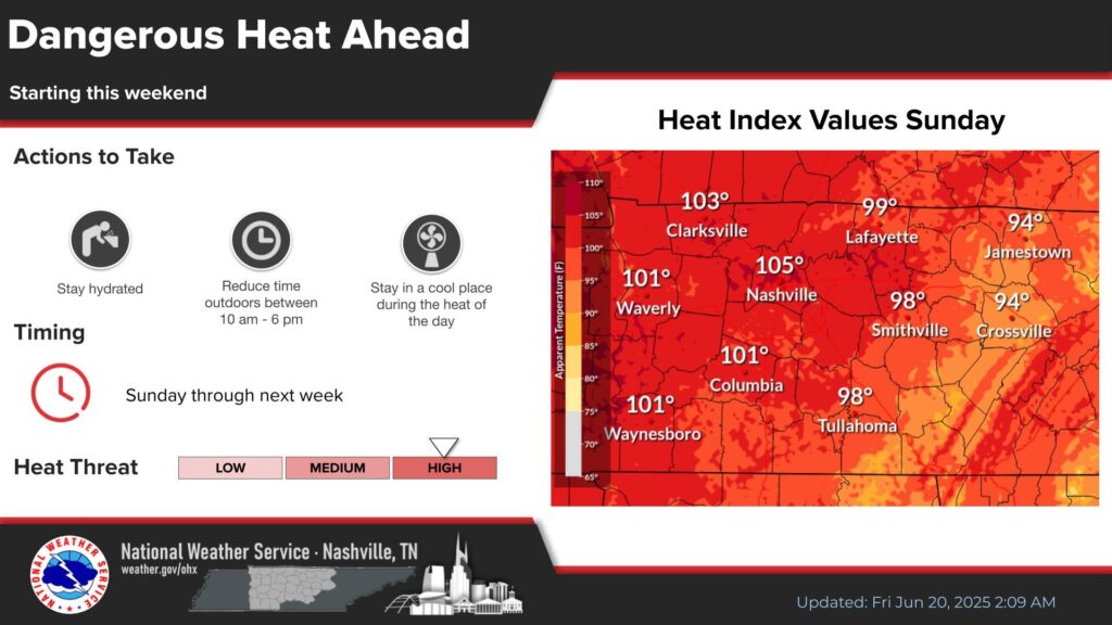
By Sunday, many areas could face heat indices high enough to trigger heat advisories. Temperatures are expected to hit near 90 degrees Fahrenheit or above, with heat indices likely climbing over 100 degrees Fahrenheit in Nashville, Clarksville, Waverly, Columbia and Waynesboro, according to the National Weather Service.
Heat will continue into next week due to two weather patterns: Moisture blowing up from the Gulf of Mexico will amplify a heat dome, an area of high pressure in the upper atmosphere that traps heat and humidity.
Humidity makes it harder for sweat to evaporate off skin, which is partially why it can be so dangerous. Another factor to consider is the “dew point” — once you hit a dew point of 75 or greater with 90 degree Fahrenheit temperatures, the heat index will be over 100 degrees Fahrenheit. Consequently, this hot and humid dynamic can make the air temperature higher than average body temperature.
In the past 10 years, Nashville has averaged about five heat advisories per year. The city had seven last year and eight in 2022 and 2023, according to Caleb Cravens, a meteorologist with the weather service.
The agency does not track types of heat advisories. Purple advisories, the “extreme heat” advisory, is considered rare. To trigger that warning, the heat index values must be forecasted at 110 degrees Fahrenheit or higher or an actual temperature of 105 degrees Fahrenheit. A heat warning requires a predicted heat index of at least 105 degrees Fahrenheit or an actual temperature of 103 degrees Fahrenheit.
 Courtesy National Climate Assessment
 The Southeast will experience more extreme heat with continued global warming.
Nashville rarely triggers heat warnings with the actual temperature. Dangers are usually tied to humidity.
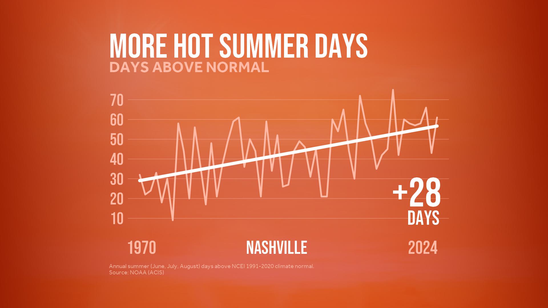
But that could change. Planetary warming under a high greenhouse gas emissions scenario is expected to add between 20 and 30 more days of at least 95 degrees Fahrenheit in most of Middle Tennessee by 2050, compared to 1991-2020 averages, according to the Fifth National Climate Assessment.