Updated 5:10 p.m.
Damage reports are coming in following the powerful hail storm that raced through the Nashville area Thursday afternoon.
The storm toppled trees and pulled up some by the roots. Many of them took out power lines as they fell, leaving at least 10,000 Nashville Electric Service customers without electricity.
We have crews responding to multiple reports of trees down like this one on Humphreys Street near Pillow Street. Call 911 ☎️ if you have downed power lines or need our assistance. #WeatherAware pic.twitter.com/yUypuJiHGv
— Nashville Fire Dept (@NashvilleFD) March 25, 2021
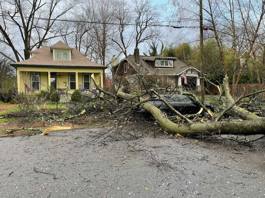
Trees also damaged cars in the street, like this hackberry resting on the trunk of a Lexus sedan in East Nashville.
 Paige Pfleger WPLN News
Straight-line winds toppled trees in East Nashville.
Marshall & Bruce Printing on Davidson Street had a window blown out, resulting in rain and wind wrecking the office.
 Submitted
 Damage inside the Marshall & Bruce Printing office on Davidson Street in Nashville.
Reported earlier
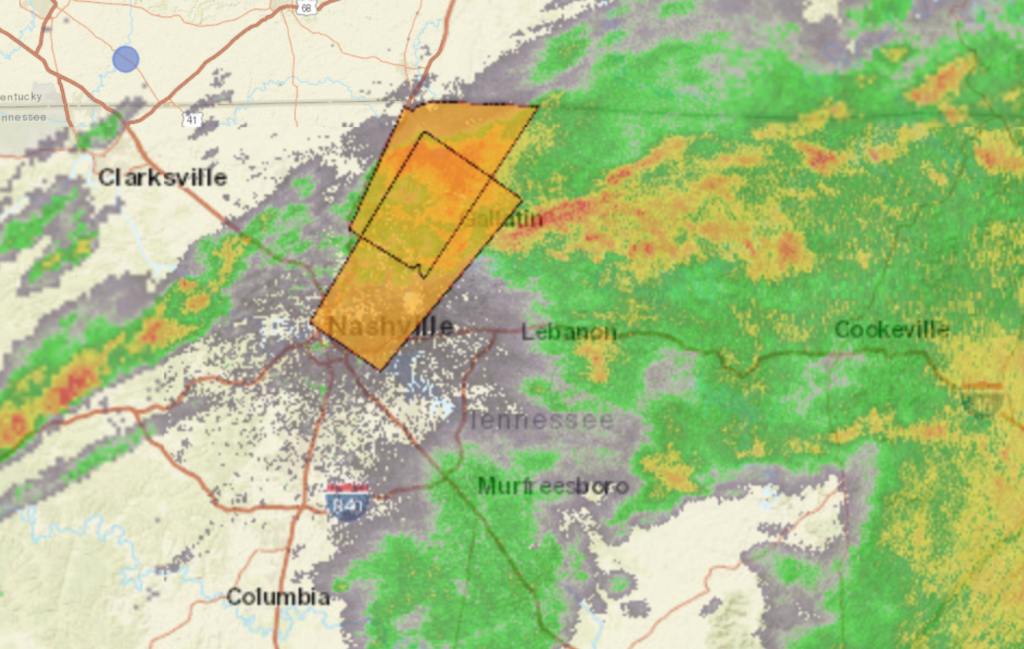
A fast-moving storm cell streaked from Franklin to Hermitage on Thursday afternoon, pounding the region with large hail and high winds.
I was just about to get out of my car when the hail storm hit East Nashville. It was so loud I genuinely thought my windshield was going to shatter. @WPLN pic.twitter.com/BnwKbyF47t
— Paige Southwick Pfleger (@PaigePfleger) March 25, 2021
The storm moved through at roughly 80 miles per hour, according to forecasters.
Nature is wild. @ms_junod just sent this from her balcony in Nashville TN #tnwx #Nashville pic.twitter.com/AEDxfnCndX
— Colton Junod, MD (@JunodColton) March 25, 2021
Amateur storm spotters posted photos of hail larger than the size of a quarter.
@NWSNashville @NashSevereWx #tspotter rivergate area pic.twitter.com/W48AOJmmCz
— k3lly ✨ (@k3llycakes) March 25, 2021
Winds ripped down tree limbs and took out some power lines. More than 8,000 Nashville Electric Service customers were immediately left without power according to an outage map.
Some structures sustained broken windows and toppled chimneys.
As of 5 p.m., there are no tornado warnings. But the National Weather Service says tornado-producing storms are still a possibility the rest of the evening. The severe weather should clear out before midnight.
All of Middle Tennessee should expect severe weather Thursday afternoon and evening.
There’s a high threat level for winds over 65 mph, flash flooding, golf-ball-size hail and potentially strong tornadoes, according to the National Weather Service. The service’s latest “situation report” is here.
Forecasters note the storms could move in quickly, with widespread tree damage and power outages possible. They’re advising organizers of outdoor events to stay weather-aware because of the speed of the storm front.
Strong tornadoes are possible from 1 p.m. to 6 p.m., with the highest risk in southwest Middle Tennessee.
The second threat, with a wide possible impact area, ranges from 6 p.m. to 11 p.m. That front comes with similar concerns about strong winds, tornadoes and flash flooding.

